
Business Details
37 Years
experience
Professional Land Surveying Services in Northern BC
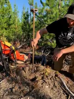
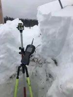
HBH Land Surveying has been a trusted leader in professional survey services for over 30 years, serving clients across northern British Columbia. Founded in 1989 in Smithers, our firm has grown to include offices in Prince George, delivering precision and expertise through advanced technologies like GPS, drones, and LIDAR. Our team of certified professionals, including British Columbia Land Surveyors and Geomatics Engineers, prioritizes client-focused solutions for legal, engineering, and industrial projects. We maintain rigorous safety, quality, and environmental standards, achieving the BCCSA's Certificate of Recognition and implementing comprehensive programs reviewed annually. With decades of combined experience, we specialize in land development, high-accuracy control networks, mining surveys, and specialized services like bathymetric and aerial topographic surveys.Our commitment extends to fostering local partnerships, including collaborations with First Nations communities, ensuring sustainable and culturally respectful practices. By integrating cutting-edge tools and methodologies, we deliver accurate, efficient results tailored to each project's unique demands. Our dedication to ongoing training and certification ensures staff remain qualified to tackle complex challenges, from remote site assessments to large-scale construction support. HBH Land Surveying remains a cornerstone of reliability in northern BC, combining technical excellence with a steadfast focus on client satisfaction.

Services
Legal Survey Services
Engineering Surveys
Construction Surveys
Mining Surveys
Drone Services
Land Development
LIDAR Surveys
Bathymetric Surveys
High Accuracy Control Networks
Certificate of Location
Details
- Year established: 1989
Highlights and features
- We have 30 years of experience in northern BC's challenging terrain.
- Our team includes certified British Columbia Land Surveyors and Geomatics Engineers.
- We utilize advanced technology like drones, LIDAR, and high-accuracy GPS systems.
- Our safety and quality programs meet BCCSA and annual compliance standards.
- We prioritize local hiring and partnerships with First Nations communities.
Associations and certifications
- Association of British Columbia Land Surveyors (ABCLS)
- Association of Canada Lands Surveyors (CLS)
- Engineers & Geoscientists British Columbia (EGBC)
- Professional Surveyors Canada
Services
Legal Survey Services
Our certified British Columbia Land Surveyors provide precise legal surveys for property boundaries, subdivisions, easements, and strata developments. We ensure compliance with provincial regulations and deliver accurate documentation for land transactions, building permits, and legal disputes. With decades of experience, we handle complex tenure issues and collaborate with government agencies to streamline processes for clients.
Engineering Surveys
We deliver high-precision control networks, tunneling surveys, and custom measuring solutions for engineering projects. Our Geomatics Engineers (P.Eng) use advanced tools like total stations and laser scanners to support infrastructure development, ensuring alignment with design specifications. This service is critical for large-scale projects requiring millimeter-level accuracy and integration with construction workflows.
Drone Services
Our drone-based LIDAR and photogrammetry services capture up to 1,000 acres per day with 3cm accuracy, ideal for inaccessible sites. We generate orthophotos, point clouds, and volumetric data for mining, forestry, and environmental monitoring. This technology reduces field time and enhances safety while providing seamless data integration for client projects.
Mining Surveys
We support mining operations with claim-to-lease surveys, earthwork volume calculations, and road layout planning. Our expertise in precision control networks and construction surveys ensures compliance with regulatory standards. By combining field data with advanced software, we optimize resource extraction processes and provide reliable data for feasibility studies and operational planning.
Land Development
We guide clients through land development challenges, from subdivision approvals to infrastructure planning. Our team collaborates with municipalities, the Agricultural Land Commission, and environmental agencies to navigate regulatory requirements. By integrating topographic surveys and engineering analysis, we create feasible, cost-effective development plans tailored to northern BC's unique landscapes.
People
Gina Hidber
British Columbia Land Surveyor
Gina Hidber brings extensive expertise in legal and engineering surveys, ensuring client projects meet regulatory standards while maintaining HBH's commitment to precision and safety.
Mark Rossmann
British Columbia Land Surveyor
Mark Rossmann specializes in high-accuracy control networks and construction surveys, leveraging his technical skills to deliver reliable data for complex infrastructure projects across northern BC.
Andrew Pearce
British Columbia Land Surveyor
Andrew Pearce focuses on land development and boundary resolution, working closely with clients to navigate regulatory processes and achieve efficient, compliant solutions.
Jennifer Ostapowich
Drafting Technician
Jennifer Ostapowich supports survey projects with detailed drafting and data management, ensuring accurate deliverables that align with HBH's quality assurance standards.
Questions
What survey services does HBH Land Surveying offer?
We provide legal surveys, engineering surveys, mining surveys, drone-based LIDAR, land development support, and specialized services like bathymetric and aerial topographic surveys.
Which areas does HBH Land Surveying service?
We operate across northern British Columbia, including the Highway 16 corridor from Prince George to Prince Rupert and the Highway 37 corridor to the Yukon border.
How experienced is HBH Land Surveying's team?
Our team has over 30 years of combined experience, with certified professionals including British Columbia Land Surveyors, Canada Lands Surveyors, and Geomatics Engineers.
What technology does HBH use for surveys?
We utilize GPS, total stations, drones, LIDAR, laser scanners, and sonar systems to ensure high accuracy and efficiency for diverse project requirements.
Does HBH work with First Nations communities?
Yes, we maintain respectful partnerships with northern First Nations, hiring local professionals and consulting on land tenure matters to support sustainable development.