Business Details
46 Years
experience
Expert Land Surveying Services in Eastern Ontario
Established in 1980, our firm has built a reputation for delivering precise and reliable surveying services across Eastern Ontario. With over four decades of combined experience, our team of certified professionals specializes in boundary surveys, land development, and advanced geospatial technologies. We leverage state-of-the-art equipment, including GNSS systems and drone technology, to ensure accuracy and efficiency for both private and government clients.Our expertise extends to legal boundary disputes, construction layout, and environmental monitoring, supported by memberships in prestigious organizations like the Association of Ontario Land Surveyors. We prioritize client collaboration, offering tailored solutions for property severances, mapping, and infrastructure projects while maintaining rigorous adherence to legal and technical standards.
Services
Boundary Line Markouts
Drone Surveys
Severance Surveys
Mapping Services
Engineering Surveys
Details
- Year established: 1980
Highlights and features
- 40+ years of boundary survey expertise since 1980
- Advanced GNSS and drone technology for precise mapping
- Certified members of Ontario and Canada Lands Surveyors
- Proven track record with government and corporate clients
- Dedicated support for property severance applications
Associations and certifications
- Association of Ontario Land Surveyors
- Association of Canada Lands Surveyors
What people say
Accurate boundary retracement
Expertise in legal disputes
Efficient project delivery
Advanced drone technology
Dedicated severance support
Services
Boundary Line Markouts
Our boundary line markouts utilize historical records and modern GNSS technology to legally define property lines. We conduct title research, field verification, and monument placement to resolve disputes and ensure compliance with Ontario's Surveys Act. Clients receive detailed reports and court-admissible documentation for property transactions or development projects.
Drone Surveys
Photogrammetric drone surveys capture high-resolution topographic data for construction monitoring and land development. We deploy multi-rotor UAVs to create 3D models, volumetric calculations, and progress reports. This technology reduces field time while maintaining precision for municipal waste sites, subdivisions, and infrastructure rehabilitation projects.
Severance Surveys
We specialize in Planning Act Consent Applications for property severances, guiding clients through municipal approval processes. Our services include reference plan preparation, title research, and coordination with health departments or legal advisors. This ensures compliant land divisions for residential or commercial sales while addressing zoning and easement requirements.
Engineering Surveys
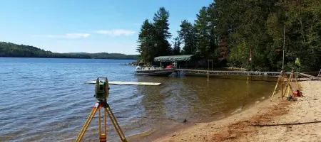
Engineering surveys support infrastructure projects with precise control points and layout verification. Using high-precision total stations and GNSS systems, we ensure accurate placement of roads, utilities, and buildings. Clients benefit from real-time data integration and compliance with municipal engineering standards for public and private developments.
Crown Lands Surveys
Crown lands surveys define boundaries for reserves, two-storey boathouses, and public access areas. We work with government agencies to establish legal descriptions for recreational, environmental, or resource management purposes. Our expertise includes historical record analysis and field verification to support land use planning and conservation initiatives.
People
Paul Miller
Managing Partner
Commissioned OLS in 1980 and CLS in 1994, Paul has 40+ years of experience in boundary disputes, title research, and expert court testimony. He leads Miller P A Surveying Ltd. and contributes to industry standards through AOLS committees.
Kevin Smith
Managing Partner
CLS and OLS since 2007/2012, Kevin specializes in cadastral surveys and photogrammetry. With NSERC grant experience, he oversees technical operations and client relations while serving on geomatics accreditation committees until 2023.
Taylor DeRuiter
Ontario Land Surveyor
Commissioned OLS in 2024, Taylor focuses on legal calculations and cadastral projects. A UNB graduate, he's pursuing P.Eng certification while managing boundary surveys and engineering projects for residential and municipal clients.
Al Karklins
Canada Lands Surveyor
With 50+ years' experience, Al specializes in international boundary projects and geomatics education. Former Ontario Hydro manager and college instructor, he now oversees complex survey analysis and historical record integration for diverse public and private clients.
Questions
Why does verifying a single survey monument cost so much?
Legal boundary verification requires title research, field evidence analysis, and adherence to Ontario's Surveys Act. Costs reflect comprehensive research, equipment, and expertise to ensure legally defensible results.
What if a neighbor removes a survey monument?
We recommend mediation first. If unsuccessful, file a police report as monument removal violates the Criminal Code. We often help resolve disputes while ensuring legal compliance for all parties.
Can survey crews legally access my property without notice?
Yes, Ontario's Surveys Act grants statutory trespass protection for legal surveys. We prioritize urban courtesy notifications but maintain legal access rights for boundary retracement work.
How do I start a property severance process?
Contact us for initial assessment, then submit a Planning Act Consent Application. We guide you through reference plan preparation, municipal approvals, and legal requirements for successful land division.
What technology do you use for mapping?
We employ Leica GNSS systems, high-precision total stations, and photogrammetric drones. This combination ensures accurate data collection for topographic maps, construction monitoring, and volumetric calculations.
Do you work with First Nations communities?
Yes, we provide survey services to six Eastern Ontario First Nations and the National Aboriginal Lands Manager Association, specializing in culturally sensitive land use and boundary documentation.