
Business Details
50+ Years
experience
Trusted Land Surveying Services in Ottawa
Farley Smith & Denis Surveying has been a trusted name in land surveying since 1908, serving Ottawa and Eastern Ontario with unmatched expertise. Our multidisciplinary team combines over a century of experience with cutting-edge technology to deliver precise boundary determinations, topographic surveys, and development planning. As registered members of the Association of Ontario Land Surveyors and the Association of Canada Lands Surveyors, we uphold rigorous standards in residential, commercial, institutional, and governmental projects. Our legacy of excellence, rooted in founder Sidney Farleys philosophy, ensures clients receive tailored solutions for complex surveying challenges.From condominium conversions to First Nation Reserve delineations, we prioritize accuracy, timeliness, and client education to prevent costly errors. Our local knowledge of the National Capital Region informs every project, from suburban expansions to major infrastructure developments. With a dedicated team of surveyors, engineers, and technicians, we maintain a client-centric approach that has earned us a reputation for reliability and innovation. Our commitment to continuous improvement ensures we meet evolving municipal bylaws and industry standards while preserving the integrity of our foundational principles.


Services
Condominium Plans
Subdivision Plans
Reference Plans
Real Property Reports
Property Line Retracements
Topographic Surveys
Construction Layout
First Nation Reserve Surveys
Details
- Year established: 1908
Highlights and features
- 116 years of continuous service to the National Capital Region
- Locally owned with deep understanding of municipal regulations
- Full-service surveying from boundary retracements to construction layouts
- Registered professionals with provincial and federal accreditation
- Proven track record in complex residential and commercial developments
Associations and certifications
- Association of Ontario Land Surveyors
- Association of Canada Lands Surveyors
Services
Condominium Plans
Our condominium plans create three-dimensional property divisions for new constructions and existing building conversions. We navigate Ontario Condominium Act requirements and municipal bylaws to prevent legal disputes. Our team provides strategic advice throughout development to ensure compliance with evolving regulations while maintaining project timelines and budgets.
Subdivision Plans
We prepare subdivision plans that legally divide land parcels while meeting municipal approval requirements. Our services include boundary analysis, topographic mapping, and environmental impact assessments to ensure successful registration at Land Registry Offices. We streamline complex applications for residential and commercial developments.
Real Property Reports
Our licensed surveyors produce legal SRPR documents that protect buyers and sellers from boundary disputes. We conduct title searches, encumbrance reviews, and field measurements to create detailed reports showing property dimensions, improvements, and encroachments for real estate transactions.
Topographic Surveys
We create high-precision topographic maps documenting natural and man-made land features for construction and development projects. Our surveys include elevation data, landscaping elements, and utility locations to serve as foundational plans for infrastructure design and site grading.
First Nation Surveys
Our Canada Land Surveyors specialize in federally regulated lands including Indigenous reserves. We provide boundary delineation and legal descriptions for resource management and infrastructure projects, combining federal standards with local knowledge of Ontario's unique land requirements.
People
Daniel B. Robinson
President / Owner
Commissioned Ontario Land Surveyor with over 35 years of experience managing surveying operations across Eastern Ontario. Specializes in client relations and regulatory compliance for large-scale development projects.
Chris Hall
Project Supervisor
Senior technician with 25+ years of experience in CAD calculations, topographic surveys, and condominium plan preparation. Expert in interpreting survey evidence for property boundary determinations.
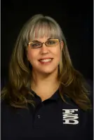
Penny Dota
Project Supervisor
Experienced project manager with expertise in survey calculations and plan preparation. Provides technical leadership for complex land development projects across Ontario.
Ljiljana Klinovski
Survey Technician
Geodesy engineer with 30 years of experience in boundary calculations and topographic surveying. Specializes in precise property line determinations and plan submissions.
Steve Maclellan
Field Survey Technician
Party chief with 35 years of field experience conducting boundary retracements and construction layout surveys across the National Capital Region.
Questions
What surveying services do you offer in Ottawa?
We provide condominium plans, subdivision surveys, reference plans, real property reports, property line retracements, topographic mapping, and construction layout services.
How long has your company been in business?
Farley, Smith & Denis Surveying has operated continuously since 1908, serving Ottawa and Eastern Ontario for over a century.
Are your surveyors licensed and accredited?
Yes, our team includes Ontario Land Surveyors registered with the Association of Ontario Land Surveyors and Canada Lands Surveyors.
Do you handle both residential and commercial projects?
We serve all sectors including residential property owners, commercial developers, and government agencies with tailored surveying solutions.
How do you ensure survey accuracy?
We use state-of-the-art equipment combined with traditional expertise, following strict provincial and federal standards for all projects.