
Business Details
13 Years
experience
Expert Land Surveying Services in Vanderhoof, BC
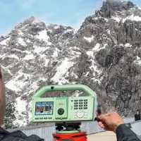
Sangha Geomatics & L has been delivering high-precision surveying solutions since 2013, combining 25 years of industry experience with cutting-edge technology. Our team specializes in legal, engineering, and aerial surveying across Vanderhoof and the Northwest Corridor, serving governments, First Nations, construction firms, and private landowners. We prioritize accuracy through state-of-the-art equipment like Leica Geosystems and DJI drones, ensuring efficient project completion without compromising quality.Our commitment to ethical practices and client collaboration has earned trust from the Yukon border to Bella Coola. Affiliated with the Association of BC Land Surveyors and Professional Surveyors Canada, we maintain rigorous standards in every project, from topographic mapping to complex infrastructure developments.
Services
Engineering Surveys
Drone Surveying
Legal Boundary Surveys
Aerial Imaging
Topographic Mapping
Subdivision Surveys
Pipeline Surveys
Building Stakeouts
Covenant Mapping
Volume Measurements
Details
- Year established: 2013
Highlights and features
- 25 years of combined surveying and construction experience
- Investment in state-of-the-art Leica Geosystems and DJI drone technology
- Specialized expertise in First Nations projects and legal boundary surveys
- Flexible pricing without compromising personalized service quality
- Proven track record with municipal and infrastructure development projects
Associations and certifications
- Association of BC Land Surveyors
- Association of Canada Lands Surveyors
- Professional Surveyors Canada
Services
Engineering Surveys
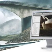
We conduct precise engineering surveys for infrastructure projects, including road layouts, bridge construction, and land development. Our team uses advanced equipment to ensure accurate measurements for municipal and private developments. Clients benefit from our expertise in translating design plans into real-world implementations with minimal margin for error.
Drone Surveying
Our DJI Matrice drone fleet captures high-resolution aerial data for 3D models, orthomosaic maps, and LiDAR point clouds. This technology enables efficient site analysis and progress monitoring for remote or complex terrains. Clients receive faster data acquisition with reduced field time compared to traditional methods.
Legal Surveys
We perform legally recognized surveys for Canada lands, easements, and rights-of-way. Our certified professionals ensure compliance with provincial and federal regulations for property transactions and dispute resolution. Clients receive court-admissible documentation for boundary postings and covenant enforcement.
Topographic Mapping
Our topographic surveys detail natural and man-made features for development planning. Using GPS and total stations, we create accurate elevation models for drainage analysis and site preparation. This service supports construction, environmental assessments, and resource management projects.
Subdivision Surveys
We facilitate legal land divisions for residential, commercial, and agricultural developments. Our process includes boundary verification, plan preparation, and municipal approval coordination. Clients receive clear title documentation for phased developments and strata projects.
People
Manny Sangha
Professional Land Surveyor
Manny Sangha is a licensed British Columbia and Canada lands surveyor with over 25 years of experience in surveying and construction. He leads projects with technical expertise while maintaining client-focused communication. His background includes extensive work on First Nations infrastructure and large-scale development projects.
Questions
What areas do you serve for surveying projects?
We operate throughout northern British Columbia, covering Vanderhoof, the Northwest Corridor, Yukon border regions, and areas down to Bella Coola.
What technology do you use for surveys?
We employ Leica Geosystems total stations, GPS equipment, and DJI Matrice drones for aerial imaging to ensure high-precision results.
Do you handle First Nations land surveys?
Yes, we have extensive experience with First Nations projects, including administration buildings and cultural site mapping since 2013.
Are your surveyors certified?
Our team includes professionals affiliated with the Association of BC Land Surveyors and Professional Surveyors Canada.
What types of deliverables do drone surveys provide?
Drone surveys produce 3D models, orthomosaic maps, thermal imaging, and LiDAR data for construction and land management applications.