Business Details
25 Years
experience
Professional Land Surveying Services in Victoria, BC
Since 2001, Polaris Land Surveying has been a leader in providing high-quality, cost-effective surveying services across British Columbia. Our business model allows tailored services to meet individual client needs, with team members assigned to projects based on location and expertise. We specialize in creating and determining legal boundaries, including subdivisions and stratas, while also solving complex spatial questions such as buildable areas, infrastructure placement, and volume calculations. Our core service areas include Victoria, Cowichan Valley, Gulf Islands, Powell River, and Creston, with a team willing to travel throughout BC, including remote locations like Atlin, Bella Coola, and Port Hardy. We have worked on diverse projects ranging from rural subdivisions to First Nation developments, serving governments, developers, and individual landowners.Our virtual office model enables us to meet clients where they are, eliminating the need for a traditional head office. With over four decades of collective experience, our team of certified professionals utilizes advanced technologies like drone photogrammetry, LiDAR, and terrestrial laser scanning to deliver precise results. We pride ourselves on our expertise in boundary determination, topographic surveys, and construction layout, with a particular focus on legal and technical challenges. Our founder played a key role in shaping the Strata Property Act, underscoring our deep industry knowledge. Polaris remains committed to exceptional service, combining local expertise with provincial reach to address the unique needs of every project.
Services
Land Development
Residential Surveys
Reality Capture
Subdivisions
Strata Developments
Air Space Surveys
First Nations Surveys
Details
- Year established: 2001
Highlights and features
- We have over 40 years of combined experience in land surveying and boundary determination.
- Our team utilizes advanced technologies like LiDAR and drone photogrammetry.
- We serve remote locations including Atlin, Bella Coola, and Port Hardy.
- Our founder helped shape the Strata Property Act, ensuring legal expertise.
- We offer tailored services with a virtual office model for client convenience.
Services
Land Development
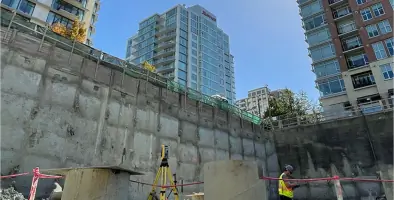
We specialize in land development projects, including subdivisions, bare land stratas, and air space parcels. Our team provides precise boundary determination, re-zoning assistance, and construction layout for urban and rural developments. With decades of experience, we guide clients through complex regulatory processes and deliver solutions tailored to municipal and provincial requirements.
Residential Surveys
Our residential surveying services include boundary surveys, easements, and building location certificates. We help homeowners resolve property disputes, prepare for renovations, and ensure compliance with local regulations. Our team combines technical expertise with clear communication to address individual property needs.
Reality Capture
We use cutting-edge technology like drone photogrammetry, LiDAR, and terrestrial laser scanning for accurate 3D mapping. This service supports infrastructure planning, construction monitoring, and environmental assessments. Our reality capture tools provide detailed spatial data to enhance project efficiency and decision-making.
Strata Developments
Polaris is a leader in strata developments, including bare land and building stratas. We played a key role in shaping the Strata Property Act and offer expert guidance on legal boundaries, communal features, and ownership structures. Our surveys ensure compliance and clarity for complex multi-unit projects.
First Nations Surveys
We collaborate with First Nations communities on treaty settlements, land administration, and infrastructure projects. Our services include boundary investigations, community mapping, and legal surveys on provincial and federal lands. We prioritize culturally sensitive approaches and long-term partnerships.
People
Brent Taylor
Senior Land Surveyor
Commissioned as a BC Land Surveyor in 1984, Brent has over 40 years of experience in project management, condominium development, and boundary law. He influenced the Strata Property Act and specializes in complex legal surveys.
Jordan Litke
BC Land Surveyor
With 20 years of experience, Jordan specializes in subdivisions, First Nation Treaty Settlements, and reality capture technologies. He joined Polaris in 2010 and expanded its drone and LiDAR capabilities.
Michael Rogers
BC Land Surveyor
Commissioned in 2016, Michael focuses on hydro, mining, and infrastructure projects. He manages operations in Powell River and brings expertise in remote-area surveys and large-scale mapping.
Andrew Christian
BC Land Surveyor
Andrew has 18 years of experience in infrastructure and First Nations projects. He joined Polaris in 2016 and specializes in legal surveys, topographic mapping, and cross-provincial boundary investigations.
Alex Gorelik
BC Land Surveyor
Commissioned in 2015, Alex focuses on residential and commercial surveys in Victoria. He has extensive municipal project experience and expertise in air space subdivisions and construction layout.
Questions
What services does Polaris Land Surveying offer?
We provide land development surveys, residential boundary surveys, reality capture (LiDAR and drone mapping), strata developments, and First Nations land surveys.
Which areas do you serve?
We operate throughout British Columbia, including Victoria, Cowichan Valley, Gulf Islands, Powell River, Creston, and remote regions like Atlin and Bella Coola.
What makes Polaris unique?
Our virtual office model, advanced technology use, and expertise in legal boundaries and strata developments set us apart.
Do you work on First Nations projects?
Yes, we collaborate with First Nations on treaty settlements, land administration, and infrastructure surveys.
How experienced is your team?
Our surveyors have decades of combined experience, including roles in shaping BC’s Strata Property Act and federal land regulations.