Business Details
Expert Land Surveying & Geomatics Services
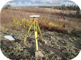
Stoffel Surveys is a professional land surveying company dedicated to delivering precise and reliable geomatics services across Manitoba. Founded by Arno Stoffel, a seasoned surveyor with over 20 years of industry experience since 1984, our team combines deep expertise with cutting-edge technology to meet diverse client needs. We specialize in construction surveys, land development, and topographic mapping, utilizing state-of-the-art equipment including GPS and CAD software. Our commitment to quality is reflected in our use of full-size 4x4 trucks for accessibility and computerized data collection systems. With a career spanning Europe and North America, Mr.Stoffel's technical proficiency ensures accurate project execution. We prioritize timely service delivery while maintaining strict adherence to professional standards. Our mission focuses on public service excellence through accurate land documentation and boundary determination. The company's operational philosophy emphasizes technological innovation and field adaptability. Client satisfaction is achieved through transparent communication and technically rigorous deliverables. Stoffel Surveys remains dedicated to advancing surveying practices while maintaining Manitoba-specific expertise.
Services
Building Location Certificates
Construction Surveys
Land Development
Topographic Surveys
Subdivision Plans
Control Surveys
Easement Plans
GIS Data Capture
Highlights and features
- We offer 20+ years of surveying experience since 1984
- Our team uses state-of-the-art GPS and CAD technology
- We operate full-size 4x4 trucks for reliable field access
- Our founder specializes in Manitoba land development projects
- We provide computerized data collection for accurate results
Services
Building Location Certificates
We provide precise building location certificates to verify property boundaries and structures. Our surveyors use GPS technology and total stations to ensure accurate measurements for residential and commercial properties. This service helps prevent boundary disputes and ensures compliance with local regulations.
Construction Surveys
Our construction survey services ensure proper building placement and dimensional accuracy. Using data collectors and CAD software, we establish reference points for foundations and infrastructure. This service supports contractors in maintaining alignment with approved plans throughout the building process.
Topographic Surveys
We create detailed topographic maps showing natural and man-made features. Our surveys capture elevation changes, vegetation, and water bodies using advanced geomatics equipment. This information supports land development and environmental planning projects across Manitoba.
Subdivision Plans
Our team prepares subdivision plans for property partitioning projects. We ensure compliance with municipal zoning bylaws and Manitoba survey standards. This service includes boundary calculations and mapping required for legal land division approvals.
GIS Data Capture
We collect and process geospatial data for land management applications. Our GIS services integrate survey measurements with digital mapping systems. This technology supports infrastructure planning and environmental monitoring projects with accurate spatial information.
People
Arno Stoffel
Founder & Professional Surveyor
Arno Stoffel has over 20 years of surveying experience since 1984. He has worked on diverse projects across Europe and North America. His expertise includes construction surveys and land development. Mr. Stoffel utilizes advanced geomatics technology for precise measurements. He remains committed to delivering quality survey services across Manitoba.
Questions
What survey services does Stoffel Surveys offer?
We provide building location certificates, construction surveys, topographic mapping, subdivision plans, and GIS data capture services across Manitoba.
When would I need a land surveyor?
You need a surveyor for property boundary verification, construction projects, land development, or legal documentation of land features.
What technology does Stoffel Surveys use?
We use GPS equipment, total stations, data collectors, and CAD software for accurate measurements and digital mapping solutions.
What areas do you serve?
We provide land surveying services throughout the province of Manitoba for residential, commercial, and municipal projects.