
Business Details
18 Years
experience
Professional Land Surveying Services in Medicine Hat
Established in 2008, Benchmark Geomatics combines traditional customer service values with cutting-edge technology to deliver precise land surveying solutions across southern Alberta. Our team brings over 30 years of combined experience in legal and construction surveying, specializing in property boundary determination, municipal compliance, and large-scale infrastructure projects. We utilize advanced tools like RPAS (drone) technology to enhance efficiency while maintaining a commitment to affordability and local community investment.Our expertise spans real property reports, land use amendments, subdivisions, and complex developments including solar farms, railways, and dam construction. As a 100% locally owned and operated Medicine Hat business, we prioritize clear communication and timely execution to meet diverse client needs.

Services
Legal Land Surveying
Construction Surveys
UAV Drone Surveys
Real Property Reports
Municipal Compliance
Land Use Amendments
Subdivisions
Condominiums
Dam Construction
Commercial Development
Details
- Year established: 2008
Highlights and features
- We are 100% locally owned and operated in Medicine Hat
- Our team has over 30 years of combined Alberta survey experience
- We use state-of-the-art RPAS (drone) surveying technology
- We offer comprehensive services from legal surveys to construction layout
- We maintain active membership in Alberta Land Surveyors' Association
Services
Legal Land Surveying
Determine precise property boundaries using scientific techniques and legal knowledge. Our Alberta Land Surveyors create legally recognized documents for real estate transactions, resolving boundary disputes and ensuring compliance with municipal regulations. Services include real property reports, easement identification, and title verification for property owners, municipalities, and financial institutions.
UAV Drone Surveys
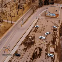
Capture high-resolution topographic data using RPAS technology. This method reduces survey time by 80% compared to traditional methods while producing detailed 3D models. Applications include construction progress monitoring, volume calculations, wetland restoration tracking, and infrastructure planning. Our certified pilots ensure accurate data collection from 120 meters above ground level.
Real Property Reports
Prepare legally binding documents showing property boundaries, structures, and encroachments. These reports satisfy requirements for real estate transactions, mortgage approvals, and municipal compliance. Our surveyors include written analysis of easements, zoning compliance, and title issues to protect buyers, sellers, and lenders from future liabilities.
Construction Surveys
Provide precise measurements for infrastructure projects including roadways, utilities, and commercial developments. Services cover building layouts, road alignment, utility placement, and as-built documentation. Our team supports projects from initial design through completion, ensuring adherence to engineering specifications and regulatory standards.
Municipal Compliance
Verify property compliance with local land use bylaws through detailed analysis. We prepare documentation for municipal submissions and obtain compliance certificates on behalf of clients. This service ensures developments meet zoning requirements for setbacks, building dimensions, and permitted uses, streamlining approval processes.
People
Adam Thompson
Project Manager - Legal Surveys
Alberta Land Surveyor with 20+ years experience in boundary determination. Holds Geomatics Engineering degree from University of New Brunswick and actively contributes to Alberta Land Surveyors' Association.
Kirby Finley
Senior Engineer - Civil Engineering
Civil engineer specializing in sustainable infrastructure design. With extensive Medicine Hat experience, he manages complex projects ensuring safety compliance and efficient implementation of engineering solutions for community development.
Graeme Teare
Project Manager - Construction Surveys
Geomatics Engineering Technologist with 10+ years managing large-scale projects in Medicine Hat. Expertise includes flood restoration, dam construction, and industrial development surveys, ensuring accurate field implementation of engineering designs.
Questions
What surveying services do you offer in Medicine Hat?
We provide legal land surveys, construction layout services, UAV drone surveys, real property reports, and municipal compliance documentation across southern Alberta.
How does drone technology improve surveying accuracy?
Our RPAS technology captures detailed 3D models from 120m altitude, achieving centimeter-level accuracy while reducing survey time by up to 80% compared to traditional methods.
Why choose local surveyors for property transactions?
Local expertise ensures familiarity with Alberta land regulations. Our Medicine Hat-based team provides faster service and better understanding of regional zoning requirements and municipal processes.
What construction projects require professional surveying?
All infrastructure projects need surveys for accurate layout, including roadways, utilities, commercial developments, and industrial facilities. We support projects from initial design through final as-built documentation.