
Business Details
49 Years
experience
Professional Geomatics Services Northern Ontario
Established in 1977, our company has built a reputation as a leading provider of professional surveying services in Northern Ontario. With over 48 years of continuous operation and more than 18,000 successfully completed projects, we combine extensive field experience with cutting-edge geomatics technology to deliver precise spatial data solutions. Our team of licensed Ontario Land Surveyors and technical professionals maintains expertise through ongoing technology integration, ensuring accurate legal boundary determinations and engineering survey services.We operate from multiple locations including Sudbury, Parry Sound, and Little Current, offering both walk-in consultations and appointment-based services to serve diverse client needs across the region.
Services
Cadastral Surveys
Engineering Surveys
Geomatics Services
Archived Records
Mobile Surveying
Details
- Year established: 1977
Highlights and features
- 48 years of continuous professional surveying experience since 1977
- Over 18,000 successfully completed survey projects across Northern Ontario
- Licensed Ontario Land Surveyors with modern geomatics technology integration
- Accredited professionals maintaining industry-leading measurement accuracy standards
- Expanded service locations in Sudbury, Parry Sound and Little Current
Associations and certifications
- Ontario Land Surveyors
- Professional Surveyors Canada
Services
Cadastral Surveys
We conduct precise legal boundary determinations using modern surveying equipment and techniques. Our licensed Ontario Land Surveyors establish, re-establish, and document property boundaries for land development, real estate transactions, and dispute resolution. This service ensures compliance with provincial survey standards and provides legally recognized documentation for property owners and municipalities.
Engineering Surveys
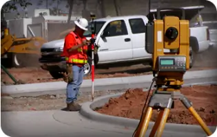
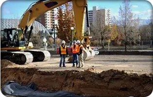
Our engineering survey services support infrastructure development through accurate topographic mapping and construction layout. We provide detailed site analysis, elevation data, and dimensional control for roadways, buildings, and utility installations. Using advanced geomatics technology, we ensure construction projects maintain proper alignment and meet engineering specifications throughout Northern Ontario.
Geomatics Services
We deliver comprehensive geospatial data solutions using terrestrial, airborne, and satellite-based technologies. Our services include 3D mapping, GIS data collection, and spatial analysis for land management, resource planning, and environmental monitoring. This technology enables clients to make informed decisions based on accurate, up-to-date geographic information across various industries.
Archived Records
We maintain and provide access to historical survey records from multiple Ontario Lands Surveyors. Our archive contains valuable documentation of past land measurements, boundary determinations, and property histories. Clients can access these records for property research, legal matters, and historical land use analysis across Northern Ontario communities.
Mobile Surveying
Our mobile surveying units provide flexible on-site data collection for industrial, commercial, and infrastructure projects. Equipped with portable geomatics technology, we conduct measurements and assessments at client locations throughout Northern Ontario. This service supports custom applications including equipment calibration, facility maintenance, and remote site evaluations without requiring physical office visits.
People
James Dorland
Vice President and Project Coordinator
Licensed Ontario Land Surveyor since 1995 with a degree in Geodesy and Geomatics Engineering. Appointed Ontario Director for Professional Surveyors Canada, actively shaping industry standards while managing survey projects and mentoring technical staff.
Questions
What surveying services do you offer in Northern Ontario?
We provide cadastral surveys, engineering surveys, geomatics data collection, archived record management, and mobile surveying services across Northern Ontario communities.
How can I book a surveying consultation?
Call 705-673-2556 to book appointments or visit our Parry Sound office Fridays 9am-5pm. Little Current location operates by appointment only.
What technology do you use for surveying projects?
We utilize terrestrial, airborne, and satellite-based geomatics technology for precise measurements, including 3D mapping systems and digital data collection tools.
Do you maintain historical survey records?
Yes, we archive survey records from multiple Ontario Lands Surveyors covering Sudbury, North Bay, Timmins, and surrounding regions.
How experienced is your surveying team?
Our licensed Ontario Land Surveyors have combined experience spanning 48 years with over 18,000 completed projects since 1977.
Where are your service locations?
We operate from Sudbury headquarters with branch offices in Parry Sound (open Fridays) and Little Current (by appointment).