Business Details
50+ Years
experience
Trusted Surveying and Engineering Solutions in Halifax
Established in 1958, our firm has built a legacy of excellence in surveying, engineering, and reality capture services across Atlantic Canada. With over six decades of collective experience, we specialize in transforming land development ideas into reality through innovative solutions tailored to municipal infrastructure, civil engineering, and digital reality capture. Our team of licensed professionals combines advanced technology with time-tested methodologies to deliver precise, actionable data for projects ranging from heritage preservation to industrial facility design. We prioritize collaboration, treating every clients project with the urgency and dedication it deserves, while maintaining rigorous quality control standards.Our deep understanding of local regulations and terrain ensures streamlined approvals and minimized project risks. As early adopters of 3D laser scanning and BIM integration, we empower clients with digital twins and as-built models that enhance decision-making throughout a projects lifecycle. Our commitment to continuous improvement and client-centric service has solidified our reputation as a trusted partner in sustainable development.
Services
Land Surveying
Civil Engineering
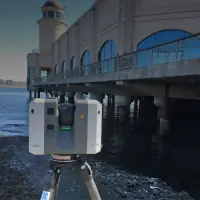
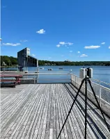
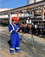
3D Laser Scanning
Reality Capture
As-Built Modeling
Heritage Surveys
Floor Flatness Analysis
Digital Twin Creation
Site Design
Subdivision Planning
Details
- Year established: 1958
Highlights and features
- We offer 65+ years of combined experience in Atlantic Canada's unique terrain and regulations.
- Our team holds professional certifications in surveying, civil engineering, and BIM technologies.
- We implement patented 3D scanning workflows for superior data accuracy and project transparency.
- Our clients benefit from direct access to senior partners throughout every project phase.
- We guarantee compliance with municipal approval processes and sustainable design standards.
Services
Land Surveying
Our professional surveyors deliver precise boundary determinations and property mapping using advanced GPS and total station equipment. We maintain extensive historical records for Nova Scotia properties dating back over a century. Our services ensure legal compliance and minimize disputes through accurate documentation of easements, rights-of-way, and land divisions.
3D Laser Scanning
We utilize terrestrial and aerial LiDAR systems to create high-resolution point clouds for industrial, commercial, and heritage sites. This technology enables millimeter-accurate documentation of existing conditions, supporting clash detection, renovation planning, and digital twin creation. Our workflows integrate seamlessly with BIM and CAD platforms for enhanced project coordination.
Civil Engineering
Our engineering team specializes in municipal infrastructure and land development projects, including stormwater management, road design, and utility planning. We provide sustainable solutions that balance client needs with environmental considerations, ensuring regulatory compliance and long-term functionality for residential, commercial, and industrial developments.
As-Built Modeling
We convert laser scan data into detailed Revit and AutoCAD models that reflect actual site conditions. These models support renovation projects, facility management, and MEP coordination by providing accurate spatial information. Our deliverables include floor plans, elevations, and 3D meshes compatible with common design software.
Heritage Surveys
We preserve cultural heritage through detailed 3D documentation of historic buildings and sites. Our surveys capture intricate architectural features and structural conditions using non-invasive scanning methods. The resulting digital records support restoration efforts, conservation planning, and historical research while maintaining the integrity of protected structures.
People
Chris Foran
Vice President/Reality Capture Lead/Partner
With over 15 years of experience in digital reality solutions, Chris leads SDMM's innovation in 3D scanning and BIM integration. He specializes in developing efficient workflows that transform complex site data into actionable project deliverables.
Dan Gerard
Vice President/Survey Lead/Partner
A licensed surveyor with expertise in boundary resolution and land development, Dan oversees SDMM's surveying operations. His technical proficiency and deep knowledge of Nova Scotia's terrain ensure accurate, legally compliant property documentation for residential and commercial clients.
Ray Landry
President/Engineering Lead/Partner
As a civil engineer with 25+ years of experience, Ray directs SDMM's engineering projects. He specializes in sustainable infrastructure design and municipal approval processes, ensuring technically sound solutions that meet regulatory requirements and client objectives.
Geoff MacLean
Project Engineer/Partner
Geoff focuses on land development and subdivision design, combining technical expertise with practical problem-solving. His collaborative approach ensures engineering solutions that balance client needs with environmental sustainability and regulatory compliance.
Jim McIntosh
Project Surveyor/Partner
A certified land surveyor with extensive experience in construction layout and boundary determination, Jim provides precise field measurements and documentation. His attention to detail ensures accurate data collection for infrastructure and development projects across Atlantic Canada.
Questions
What surveying and engineering services does SDMM offer?
We provide land surveying, civil engineering design, 3D laser scanning, reality capture, as-built modeling, heritage surveys, and subdivision planning services for commercial and industrial clients.
Which regions does SDMM serve?
Our primary service area includes all four Atlantic Canadian provinces: Nova Scotia, New Brunswick, Prince Edward Island, and Newfoundland and Labrador.
How does SDMM use 3D laser scanning technology?
We employ high-precision laser scanning to create digital twins, as-built models, and point cloud datasets that enhance project accuracy and decision-making.
Can SDMM assist with municipal approval processes?
Yes, our team has extensive experience navigating municipal regulations and securing development approvals for infrastructure and land use projects.
What industries benefit from SDMM's reality capture solutions?
Our reality capture services support architecture, construction, heritage conservation, industrial facilities, and infrastructure development sectors across Atlantic Canada.