
Business Details
45 Years
experience
Kelowna's Premier Land Surveying Services
Ferguson Land Surveying-GMTCS Ltd. has been a trusted provider of professional land surveying services in the Central Okanagan for over four decades. Established in 1981 by Tom Ferguson, our team combines extensive experience with cutting-edge technology to deliver precise and reliable surveying solutions. We collaborate closely with architects, engineers, and legal professionals to ensure projects meet municipal and provincial standards while prioritizing client satisfaction.Our new owners, Colin Ferguson and Cameron Henry, continue this legacy of excellence, offering tailored services for both commercial and residential developments. With a focus on innovation and integrity, we remain committed to advancing the land development needs of our clients through expert boundary determination, topographic mapping, and strata planning.
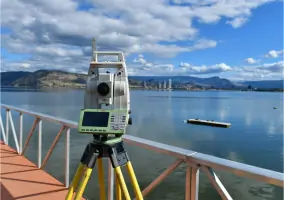
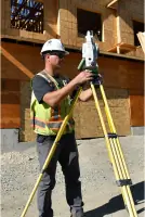
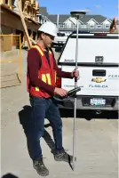
Services
Legal Surveys
Topographic Surveys
Building Layouts
Subdivision Plans
Canada Lands Surveys
Details
- Year established: 1981
Highlights and features
- We offer over 40 years of specialized land surveying experience in the Central Okanagan.
- Our team includes certified British Columbia Land Surveyors with advanced geomatics expertise.
- We guarantee accurate boundary determinations and legally compliant survey documentation.
- Our client-focused approach ensures timely project completion with personalized service.
- We utilize cutting-edge technology for precise topographic mapping and construction layouts.
What people say
Exceptional customer service
Always on time
Precise work
Professional team
Highly recommend
Services
Legal Surveys
Our certified British Columbia Land Surveyors conduct comprehensive legal surveys to establish property boundaries. We research title documents, perform precise measurements, and prepare subdivision plans, strata developments, and easement agreements. These surveys ensure compliance with provincial regulations for land transactions and development projects.
Topographic Surveys
We create detailed topographic surveys showing natural and man-made features, elevations, and contours. These surveys support urban planning, construction projects, and volumetric calculations. Our data collection includes buildings, roads, and terrain characteristics for accurate site analysis.
Building Layouts
Our team ensures precise building positioning through layout surveys and surveyor certificates. We collaborate with designers and contractors to verify compliance with municipal bylaws, preparing official documentation that confirms property improvements meet legal requirements.
Subdivision Plans
We specialize in creating subdivision plans for landowners and developers. Our process includes boundary determination, municipal coordination, and preparation of legal documents required to divide land into separate parcels for residential or commercial use.
Canada Lands Surveys
We conduct surveys on Crown land under the direction of the Surveyor General of BC. Our services include foreshore leasing surveys and other federal land transactions, ensuring compliance with government regulations for public land use and development.
People
Colin Ferguson
Partner
B.Sc. Geomatics Engineering graduate with BC Land Surveyor certification since 2010. Specializes in integrating modern technology into surveying practices while maintaining family business legacy.
Cameron Henry
Partner
B.Sc. Geomatics Engineering graduate with BC Land Surveyor certification since 2010. Brings extensive legal surveying experience from Alberta oil and gas industry to Okanagan land development projects.
Ryan Delaurier
Land Surveyor
B.Tech graduate with Alberta and BC Land Surveyor certifications. Specializes in field operations and technical execution of complex surveying projects across the Okanagan region.
Rebecca Chapple
Office Manager
Administrative leader since 2014, managing day-to-day operations and client communications. Ensures smooth business processes and maintains organizational efficiency for surveying operations.
Questions
What is the role of a British Columbia Land Surveyor?
A BCLS legally determines property boundaries, prepares official survey documents, and ensures compliance with provincial land use regulations for development projects.
How do subdivision plans benefit property developers?
Subdivision plans legally divide land into parcels, enabling proper municipal approval processes and facilitating real estate transactions for residential or commercial development.
What information does a Surveyor's Certificate provide?
Official document showing building locations relative to property lines, registered charges, encroachments, and precise property dimensions for legal compliance.
How are property boundaries marked when original posts are missing?
We conduct reposting surveys to recreate missing corners, prepare legal posting plans, and register new monuments at the Land Title Office for future reference.
What areas does FLSG serve?
We primarily serve Kelowna and the Central Okanagan region, with experience in both urban and rural land surveying projects across British Columbia.