
Business Details
Professional Land Surveying Services in BC
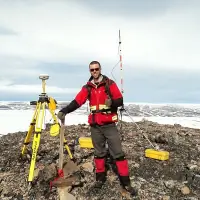
Summit Land Surveying is a professional land surveying firm with offices in Victoria and West Kelowna, British Columbia. Our team of certified professionals, including Jason Kozina, Jacob Wall, and James Thomas, brings decades of combined experience serving private and public sector clients across multiple industries. We specialize in residential, commercial, and environmental surveying projects, utilizing advanced technologies like robotic total stations, GNSS, and drone-based aerial imaging. Our commitment to precision, ethical standards, and client collaboration ensures efficient project completion while adhering to regulatory requirements.With deep local knowledge of Vancouver Island, the Gulf Islands, and the Okanagan region, we provide tailored solutions for boundary determination, subdivision planning, construction layout, and geospatial data analysis. Our membership in the Association of British Columbia Land Surveyors underscores our dedication to maintaining the highest professional standards.


Services
Residential Surveys
Cadastral Surveys
Topographic Surveys
Construction Surveys
Environmental Surveys
Geodetic Surveys
Subdivision Plans
Strata Plans
Easement Plans
Air Space Parcels
Highlights and features
- We offer over 25 years of combined experience in BC land surveying projects.
- Our team uses advanced technologies like robotic total stations and drone imaging.
- We maintain strict ethical standards through ABCLS membership and certification.
- Our local expertise spans Vancouver Island, Gulf Islands, and Okanagan regions.
- We provide comprehensive solutions from boundary determination to construction layout.
Associations and certifications
- Association of British Columbia Land Surveyors (ABCLS)
Services
Residential Surveys
Residential surveys establish property boundaries for home purchases, renovations, or building permits. Our team marks boundaries for fence installations, creates site plans for zoning compliance, and prepares building location certificates. We use modern equipment to ensure accurate measurements for additions, renovations, and mortgage requirements.
Cadastral Surveys
Cadastral surveys determine legal property boundaries for subdivisions, strata developments, and easements. We prepare registered plans for land title office submissions, including rights-of-way, air space parcels, and foreshore leases. Our certified surveyors ensure compliance with BC land title regulations and municipal planning requirements.
Topographic Surveys
Topographic surveys map ground features and elevations for development projects. We create contour maps showing buildings, utilities, and natural features to support civil engineering designs, subdivision planning, and terrain modeling. Drone-based aerial imaging provides high-resolution visual overlays for accurate project visualization.
Construction Surveys
Construction surveys ensure proper building placement and infrastructure alignment. Our services include excavation layout, foundation staking, and as-built documentation for building inspections. We provide precise benchmarks and engineering layout support throughout project lifecycles from design to completion.
Environmental Surveys
Environmental surveys support ecological assessments by mapping riparian areas and monitoring wells. We collaborate with qualified environmental professionals to provide precise positional data for regulatory compliance. Our surveys help identify sensitive areas and support sustainable development practices.
People
Jason Kozina
BC Land Surveyor
Jason has 25+ years of BC land surveying experience, specializing in Vancouver Island projects. He holds a BCIT degree and BC Land Surveyor commission since 2000. His expertise includes municipal approvals, boundary disputes, and large-scale developments.
Jacob Wall
BC Land Surveyor
Jacob graduated with honors from Red River College in 2007 and became a BC Land Surveyor in 2019. He combines technical expertise with software development skills, focusing on technological innovation in surveying practices across the Okanagan region.
James Thomas
BC Land Surveyor
James has 12+ years of surveying experience across Canada, including northern and mountainous regions. A 2011 University of New Brunswick graduate, he specializes in large infrastructure projects and brings technical expertise to Summit's Okanagan operations.
Questions
When is a land survey needed for property purchase?
Residential surveys are recommended before buying land to verify boundaries and prepare site plans for building permits.
Can I move property survey markers myself?
Only certified BC Land Surveyors have legal authority to set or replace survey monuments.
Are land survey maps important for future disputes?
Yes, survey maps provide permanent records that help resolve boundary disputes and plan property improvements.
Is a land survey a legal document?
Yes, registered survey plans are legal documents prepared for specific purposes like property transactions.
Do survey records become public documents?
Surveys registered with land title offices become public records, while others remain private client documents.
What technology does Summit use for surveys?
We use robotic total stations, GNSS systems, digital levels, and drone-based aerial imaging for accurate results.