Business Details
Expert Utility Locating & Subsurface Engineering Solutions
Geoscan Subsurface Surveys Canada, a T2 Utility Engineers company, has established itself as Canada's leading provider of subsurface utility engineering, ground penetrating radar, and surveying services. Since our founding, we have prioritized innovation, safety, and precision in every project we undertake. Our team of registered utility locating technicians and professional engineers delivers cutting-edge solutions across civil engineering, energy, and environmental sectors. We maintain strict adherence to ASCE 38-22 standards while pioneering industry advancements through our collaboration with ASTTBC on the Registered Utility Locator Technician certification program. With major offices in Vancouver, Victoria, and Kelowna, our nationwide presence enables comprehensive project execution from small-scale residential developments to large infrastructure initiatives. Our commitment to technological advancement is matched by our dedication to workforce development, having trained over 75% of our staff through our proprietary in-house development program.We maintain COR certification and Worksafe BC registration as testament to our safety leadership, while our integration with the Kiwa Group of companies ensures access to global best practices. Our proprietary methodologies have reduced project risks by 30% across 10,000+ completed projects, including specialized applications in archaeological geophysics and forensic investigations. We maintain transparency through detailed 2D/3D documentation and real-time data sharing, ensuring clients receive actionable insights at every project stage. Our industry leadership is demonstrated through our role in developing municipal SUE procurement guidelines and maintaining 100% compliance with evolving regulatory frameworks.
Services
Subsurface Utility Engineering
Utility Line Locating
GIS Utility Mapping
Archaeological Geophysics
Ground Penetrating Radar
Topographic Surveys
Void Detection
Deformation Monitoring
Underground Oil Tank Locating
Construction Layout Surveys
Highlights and features
- We employ Registered Utility Locator Technicians (RULT) certified through ASTTBC
- Our SUE projects reduce project risks by 30% according to University of Toronto studies
- We maintain COR certification and Worksafe BC registration for safety compliance
- Our team includes professional engineers and surveyors with 10+ years average experience
- We utilize state-of-the-art GPR and EM equipment for accurate subsurface mapping
Associations and certifications
- ASTTBC
- Worksafe BC
- COR
What people say
Rigorous methodology
Consistent professionalism
High-quality reporting
Adaptability to unique circumstances
Respectful approach to sensitive contexts
Services
Subsurface Utility Engineering
Our Subsurface Utility Engineering services utilize ground penetrating radar and electromagnetic equipment to map underground infrastructure with 95% accuracy. We follow ASCE 38-22 standards to deliver quality level A-D data that reduces project risks by 30%. Our engineers produce stamped CAD drawings that integrate with municipal planning systems.
Utility Line Locating
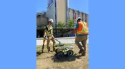
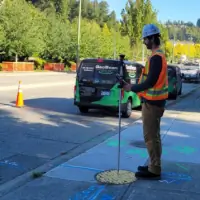
We employ state-of-the-art GPR and EM technologies to identify underground utilities with centimeter-level precision. Our RULT-certified technicians mark locations of gas, water, electrical, and communication lines to prevent excavation damage. We provide 2D PDF sketches and detailed work orders for safe ground disturbance.
GIS Utility Mapping
Our GIS specialists create interactive utility maps that help municipalities manage infrastructure networks. We integrate spatial data with simulation tools to optimize utility planning and emergency response. Our digital mapping solutions improve asset management efficiency by 40%.
Archaeological Geophysics
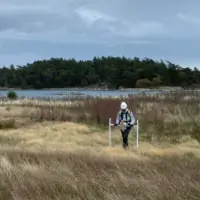
We use magnetometry and GPR to non-invasively detect subsurface archaeological features. Our technology identifies unmarked graves, ancient structures, and burial sites with 90% accuracy. We collaborate with archaeologists to provide spatial data that guides excavation planning.
Precision Surveying
Our professional surveyors use LiDAR, UAVs, and Leica equipment to deliver topographic and construction layout surveys. We provide deformation monitoring and as-built documentation with millimeter-level accuracy. Our services support infrastructure projects from initial design through final construction phases.
Questions
What is Subsurface Utility Engineering (SUE)?
SUE combines geophysical methods and surveying to map underground utilities. We use GPR and electromagnetic equipment to create accurate utility maps that reduce project risks by 30% according to University of Toronto studies.
How does utility line locating work?
We use ground penetrating radar and electromagnetic equipment to detect underground utilities. Our RULT-certified technicians mark locations of gas, water, electrical, and communication lines to ensure safe excavation.
What GIS services do you offer?
We create interactive utility maps that help municipalities manage infrastructure networks. Our digital mapping solutions integrate with planning systems to optimize utility management and emergency response.
Do you provide archaeological geophysics services?
Yes, we use magnetometry and GPR to non-invasively detect subsurface archaeological features. Our technology identifies unmarked graves and ancient structures with 90% accuracy for heritage preservation projects.
What surveying services are available?
We offer topographic surveys, construction layout, deformation monitoring, and as-built documentation using LiDAR, UAVs, and precision instruments with millimeter-level accuracy.
Which areas do you service?
We operate throughout British Columbia with offices in Vancouver, Victoria, and Kelowna. Our service areas include Surrey, Langley, Kamloops, Nanaimo, and Prince George with nationwide project capabilities.