Business Details
27 Years
experience
Your Trusted Land Surveying Partner in Alberta
Precision Geomatics has been delivering professional land surveying and mapping services since 1999, specializing in the energy, construction, and land development industries. Our approach begins with a thorough needs analysis to identify efficiencies and improve project outcomes. With a team of experienced professionals, we provide full-service solutions for midstream pipeline projects, including planning, preconstruction, construction, legal, and integrity surveys. Our commitment to quality is demonstrated through rigorous cost control systems, comprehensive QA/QC reporting, and innovative data technology integration.We foster a collaborative corporate culture that encourages knowledge sharing and continuous improvement, ensuring timely and budget-conscious delivery. Our agile team structure enables rapid response to client needs while maintaining the highest standards of accuracy and reliability. Backed by decades of industry experience, we serve clients across Alberta, British Columbia, and Saskatchewan from strategically located offices.
Services
Land Surveying
Pipeline Integrity Surveys
Bathymetric Surveys
Line Locating
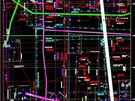
Mapping & GIS
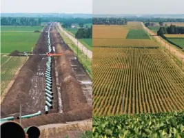
Pipeline Right of Ways
Wellsite Surveys
Reclamation Surveys
3D Mapping
Property Boundaries
Details
- Year established: 1999
Highlights and features
- We offer 25+ years of specialized experience in energy sector surveying
- Our team provides full-service pipeline project support from planning to integrity assessments
- We implement rigorous cost control systems with multiple tracking reporting mechanisms
- Our QA/QC processes ensure construction accuracy through comprehensive field verification
- We combine cutting-edge technology with hands-on field expertise for optimal results
Associations and certifications
- Canadian Association of Pipeline and Utility Locating Contractors
- Canadian Council for Aboriginal Business
What people say
Outstanding service
Technical expertise
Reliable delivery
Client-focused approach
Accurate results
Services
Land Surveying
Our land surveying services combine traditional techniques with modern technology to accurately determine property boundaries, elevations, and natural features. Using advanced GNSS RTK systems and LiDAR technology, we deliver precise measurements for legal documentation, construction projects, and land development. Our certified surveyors provide reliable data that meets regulatory requirements while supporting informed decision-making for both private landowners and major infrastructure projects.
Pipeline Integrity Surveys
We conduct comprehensive pipeline integrity assessments using advanced surveying techniques to ensure safety and regulatory compliance. Our services include in-line inspection data analysis, visual inspections, and leak detection mapping. By maintaining accurate records of pipeline conditions and implementing proactive monitoring systems, we help energy companies prevent failures and extend infrastructure lifespan while maintaining operational efficiency.
Bathymetric Surveys
Our bathymetric surveys use echosounder technology integrated with GNSS systems to create detailed underwater terrain models. These surveys support pipeline routing, flood mitigation planning, and environmental assessments by mapping lake and riverbed topography. The data collected helps engineers design infrastructure projects that account for underwater conditions while ensuring compliance with environmental regulations.
Line Locating
We provide professional utility locating services using state-of-the-art equipment to identify underground pipelines, power lines, and other buried infrastructure. Our accurate mapping prevents damage during excavation projects, reducing safety risks and avoiding costly delays. By maintaining comprehensive records of utility locations, we help clients comply with safety regulations while ensuring efficient project execution across Alberta.
Mapping & GIS
Our GIS and mapping services integrate aerial imagery, LiDAR data, and field measurements to create comprehensive spatial datasets. We develop customized mapping solutions for land development, environmental monitoring, and infrastructure planning. By maintaining accurate digital terrain models and property records, we support decision-making processes with reliable geospatial information that meets regulatory requirements and project specifications.
People
Darren Eklund
President
With extensive industry experience, Darren Eklund leads Precision Geomatics as President since 2018, driving strategic growth while maintaining technical excellence in surveying operations.
Roy Devlin
Former President
Roy Devlin served as President before transitioning to a leadership role focused on business development, leveraging decades of surveying industry expertise to expand company capabilities.
Chad French
As part of our leadership team, Chad French contributes specialized surveying knowledge and operational experience to ensure high-quality service delivery across multiple project sectors.
Chad Dahlseide
Chad Dahlseide brings technical expertise to our survey operations, supporting complex projects with hands-on field experience and advanced mapping technology proficiency.
Mike Kim
Mike Kim contributes to our surveying operations with specialized skills in data collection and analysis, ensuring accurate results for both land development and energy sector projects.
Questions
What surveying services do you offer for energy sector projects?
We provide comprehensive surveying solutions including pipeline right-of-way mapping, wellsite surveys, and pipeline integrity assessments specifically tailored for energy sector clients.
Do you provide services outside Alberta?
While based in Alberta, we serve clients across Western Canada including British Columbia and Saskatchewan for major energy and infrastructure projects.
How do you ensure survey accuracy?
We use advanced GNSS RTK systems, LiDAR technology, and rigorous QA/QC processes to maintain high accuracy standards in all survey deliverables.
Can you handle both small and large projects?
Our flexible team structure allows us to efficiently manage projects of all sizes from small boundary surveys to large-scale pipeline developments.
What technology do you use?
We utilize modern surveying equipment including GNSS systems, LiDAR scanners, and advanced GIS software to deliver precise, timely results.
Are you certified for Aboriginal-owned business partnerships?
Yes, we are a certified Aboriginal-owned surveying company through the Canadian Council for Aboriginal Business.
Videos